The Best Colorado Roads -- So Far
Some people collect national park stamps, or passport stamps. I like to collect America’s Byways.
America’s Byways are recognized by the federal government as having some kind of archeological, cultural, historic, natural, recreational, or scenic scenic significance. Some of the the most famous roads are among them: Route 66, Highway 1 in California, Blue Ridge Parkway, Beartooth Highway, and the Florida Keys, for example. So when you’re on one of America’s Byways, you’re in good company.
In Longmont I’m lucky enough that I can drive three byways there-and-back and be home by mid-afternoon: Cache La Poudre-North Park, Trail Ridge Road, and Peak to Peak.
It’s way better than Utah, but it’s a closer call compared to California. I’m in the minority that didn’t love Highway 1 (I drove southbound from Monterey to Santa Barbara … on Thanksgiving), but I did love Highway 395 and all the Sierra Nevada passes (which I drove … on Christmas). I even once found myself photographing Mount Whitney (the highest point in the contiguous US) and Badwater Basin (in Death Valley National Park) in, quite literally, the same day. I didn’t realize until afterward!
The Sierra Nevadas run from 4000 feet in the valleys to over 12,000-foot peaks (I should know, I flew over them once!) whereas the Rockies go up to 14,000 feet but start from valleys often around 9000 feet already. Basically … The Sierra Nevadas are more impressive. Does that make me a bad Coloradan?
Here’s a quick overview of some favorites. It turns out some of the famous ones aren’t all they’re cracked up to be. And I’ve attached images when I can, i.e. when I wasn’t using certain devices.
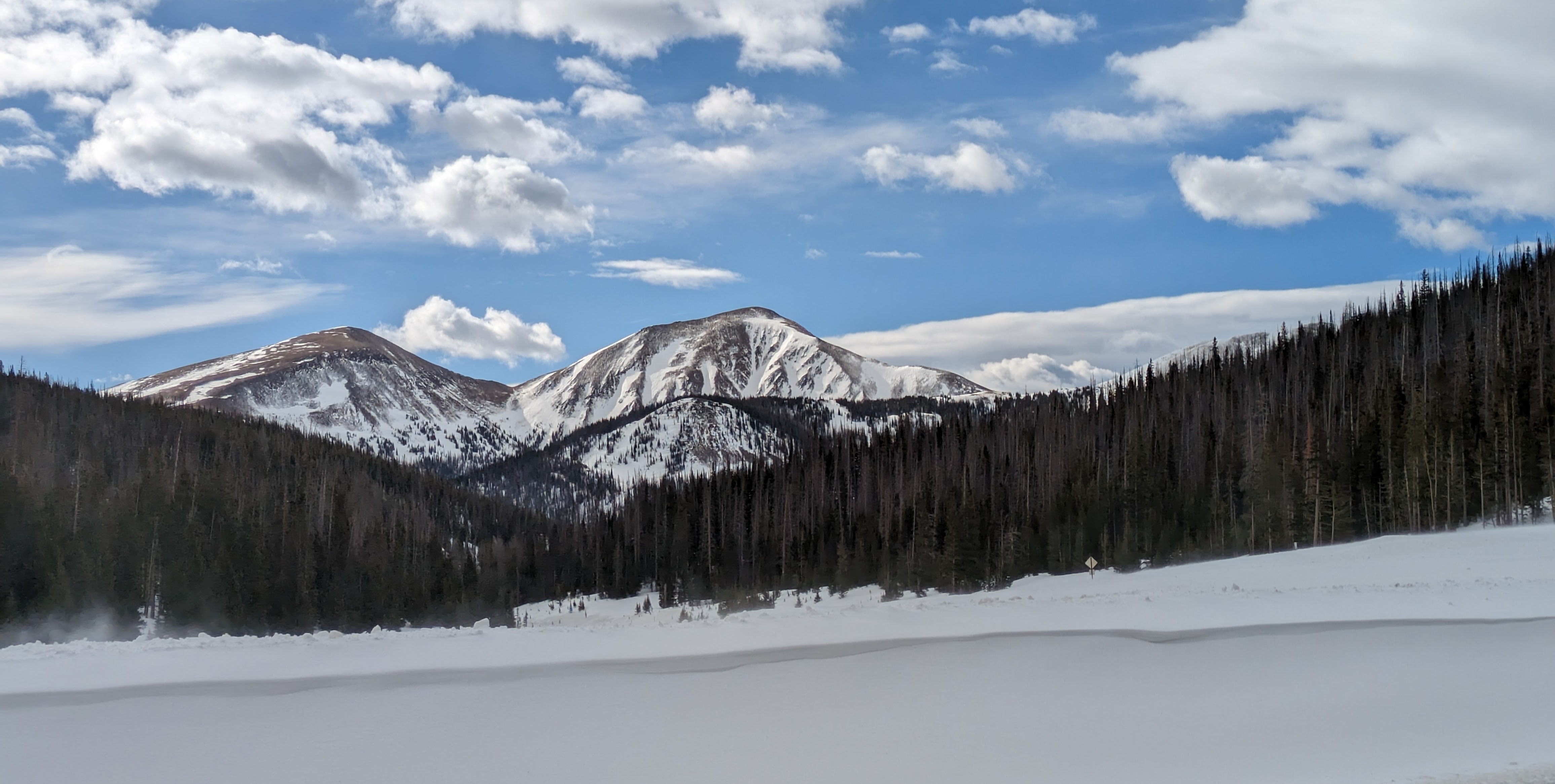
Cache La Poudre-North Park
This one travels west from Fort Collins over Cameron Pass toward Walden. The crowds thin to nearly nothing after the first hour. The pass is so incredible you just want to stop the car in the road, I’ve seen a moose just several yards away, and I’ve had great conversations with photographers out there! One gentleman was the rare Pentax DSLR user who told me he’d never upgrade, and if he did, he’d stay with Pentax. It opens into a wide valley with a wildlife refuge at the center and surrounded on all sides by high mountains. It’s a 10 / 10 would drive again.
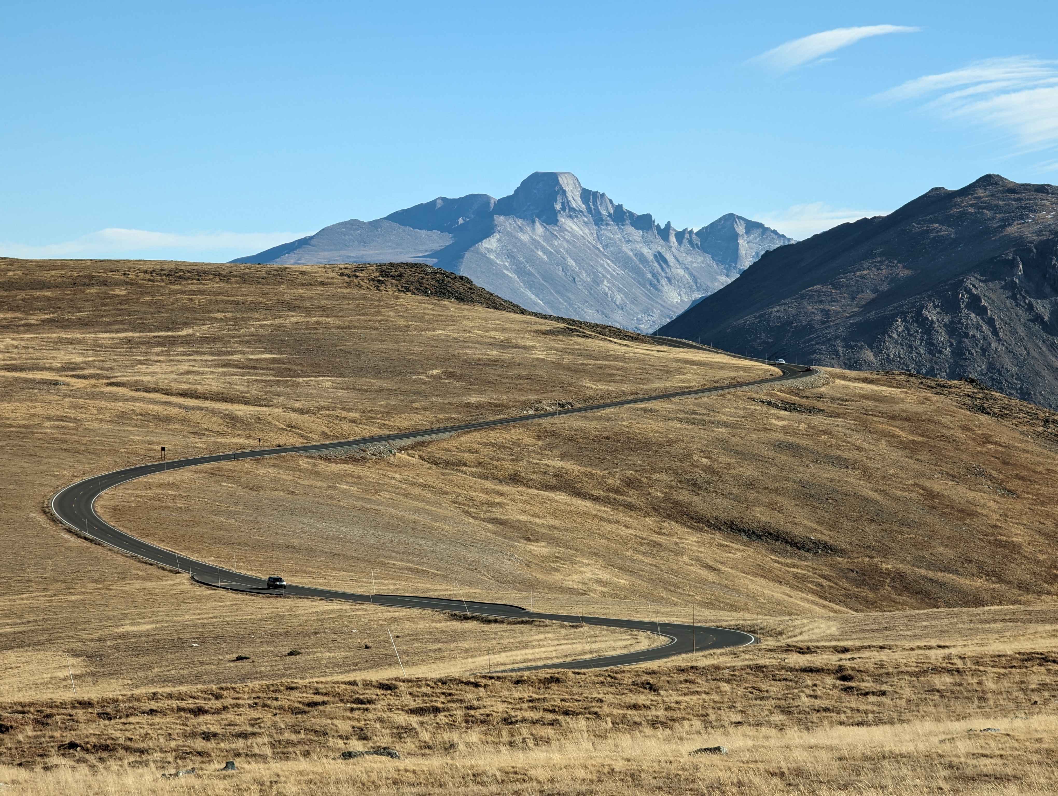
Trail Ridge Road
Trail Ridge Road is another special road — and a well-known one at that. Timed entry at Rocky Mountain National Park doesn’t really matter, because it’s easy to arrive before 9am or after 3pm to catch sunrise or sunset and completely avoid the issue. I just wish the views lasted more than a few minutes, and I wish I could take cool car pictures without getting eyeballed by every passer-by. This is definitely a drive-again road, and it loses none of its majesty on the fourth drive.
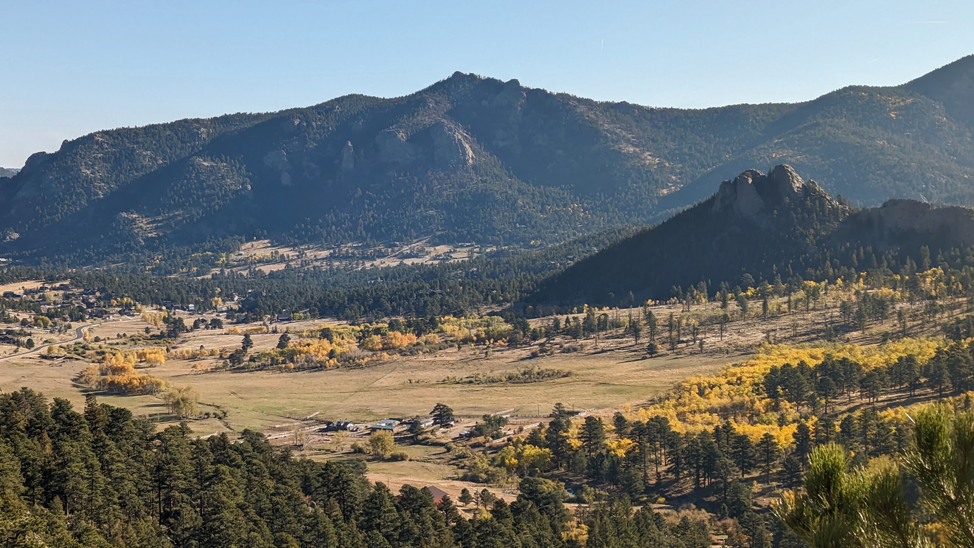
Peak to Peak
The Peak to Peak Byway is another one I can drive in just a half day there and back, and I can add some variety by taking different feeder and exit roads as it runs north-south. There are tight canyons (from Loveland), fast sweepers but busy (north Longmont), quiet save cyclists (mid-Longmont), a stunning dam (from Boulder), and more. I’ve even seen a Porsche owners club on a nice drive there before. I’ve taken some beautiful images of autumn colors there, taken friends on scenic drives through during my short-lived ownership of the BMW M240i, and used images there in slide decks at work. (Easily among my favorite parts of working on Camera!) I love the wide-open views and relatively quiet traffic. Honestly, considering how many people live in the Denver area, it’s a wonder this road is as empty as it is.
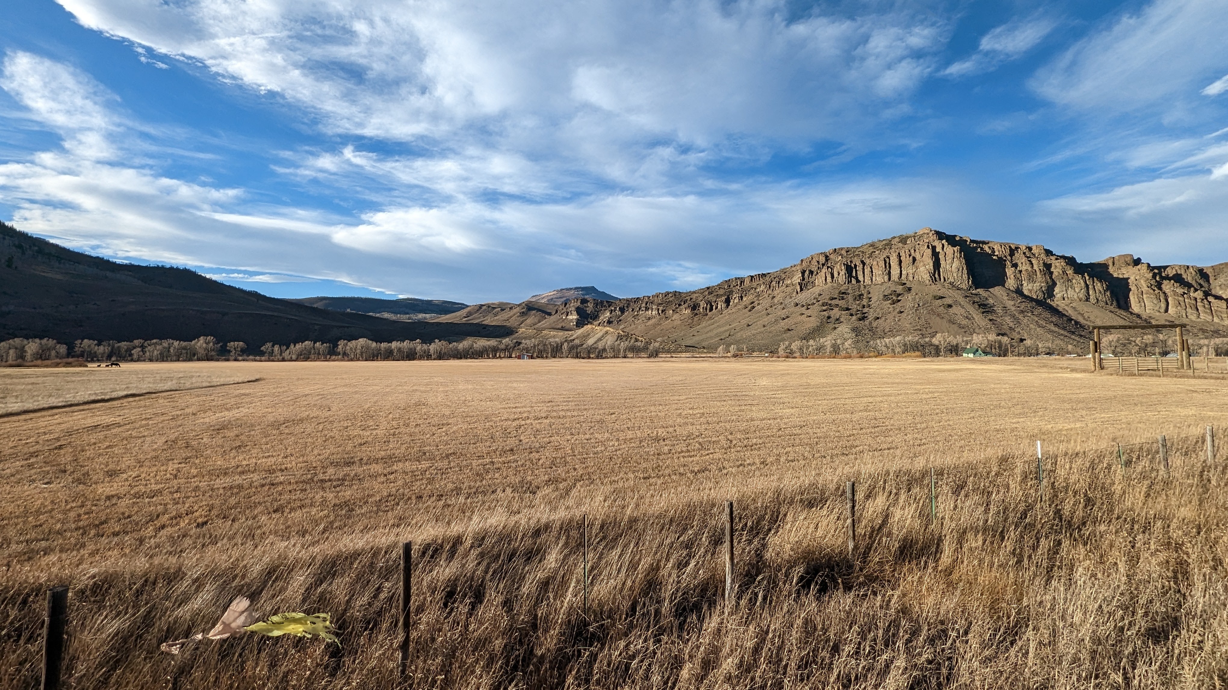
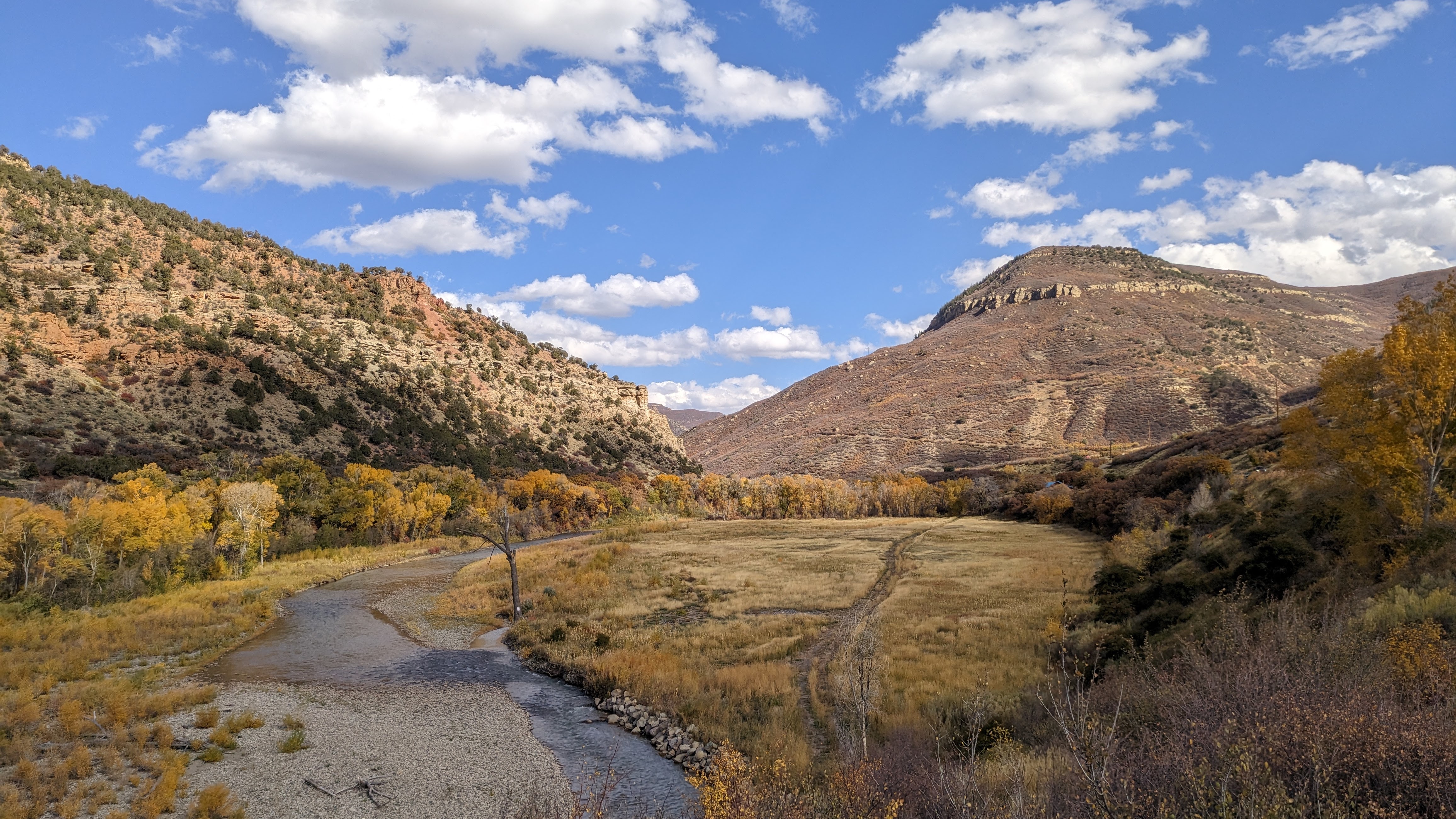
Colorado River Headwaters
I found myself on the Colorado River Headwaters byway almost by accident, turning east on my path toward Durango. It was incredibly strange to see how small the river is at its headwaters, knowing how huge it gets further down. I later learned that despite Denver being on the east side of the Continental Divide and the headwaters in the west, a huge volume of water is diverted across it through deep, long tunnels. I’m glad, because Colorado’s western slope gets 80% of the precipitation (upslope flow) but only 20% of its population. I also appreciated the peace, emptiness, smooth roads, small town, and tiny farms along the way.
West Elk Loop (McClure Pass)
Sadly, I only drove a small part of the West Elk Loop, and it wasn’t memorable. It wasn’t it’s fault being bookended by the epic Top Of The Rockies and San Juan Skyway (East) roads – it’s just hard to shine there. I’d love to come back and hit the rest, but the section I saw was just “meh”.
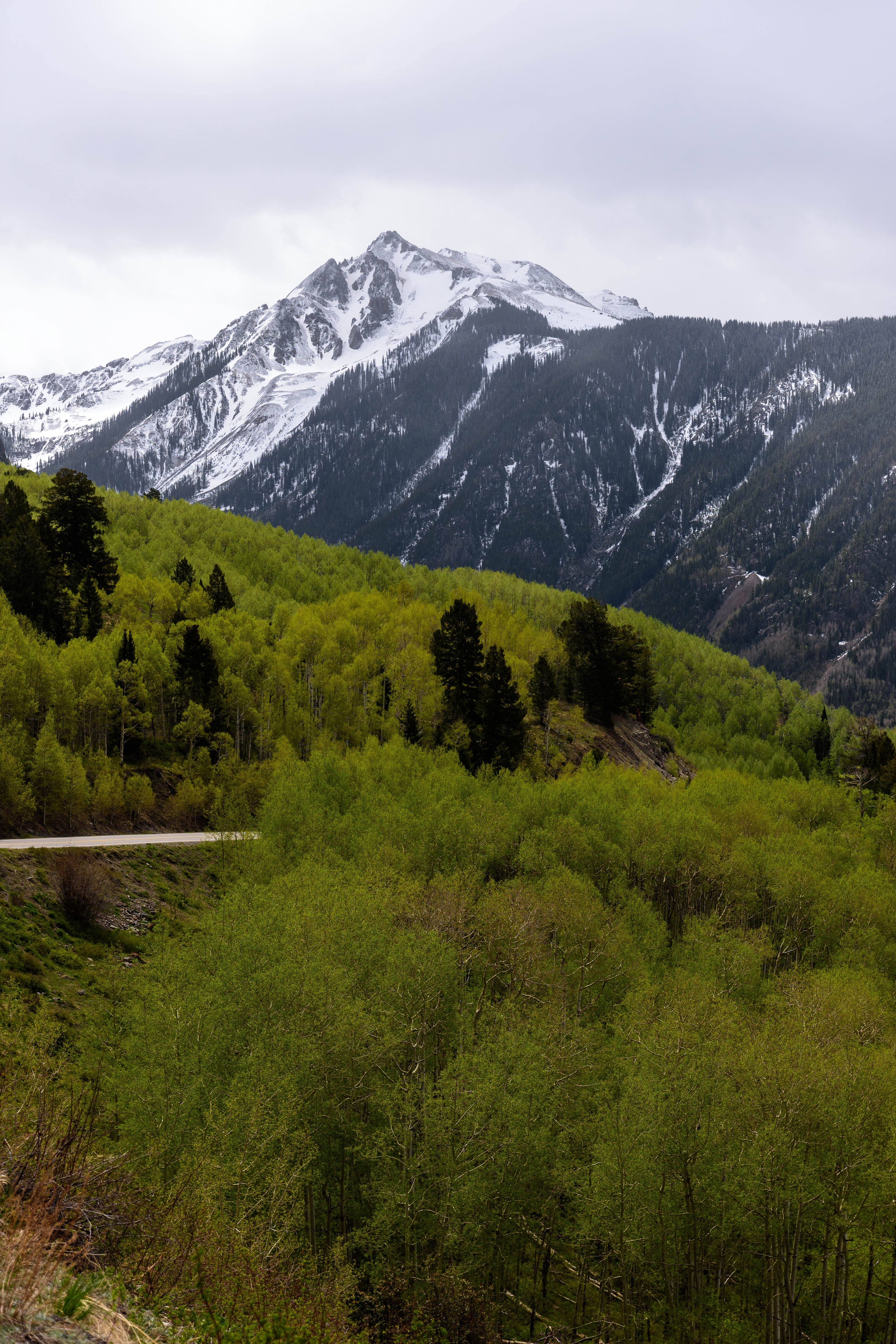
San Juan Skyway (West)
The San Juan Skyway was one of the first roads I determined to drive before even moving to Colorado – even as far back as living in California and dreaming of an epic road trip some autumn. But I found myself there entirely by accident, on a longer trip to the Grand Canyon, and only realized when I drove by a sign with its name on the label. It was no slouch at all – incredible views the whole way through of snow-capped, jagged mountains and alpine lakes – and well worth returning someday. It would make a wonderful route to Mesa Verde and the other four corners-area national parks and monuments.
San Juan Skyway (East)
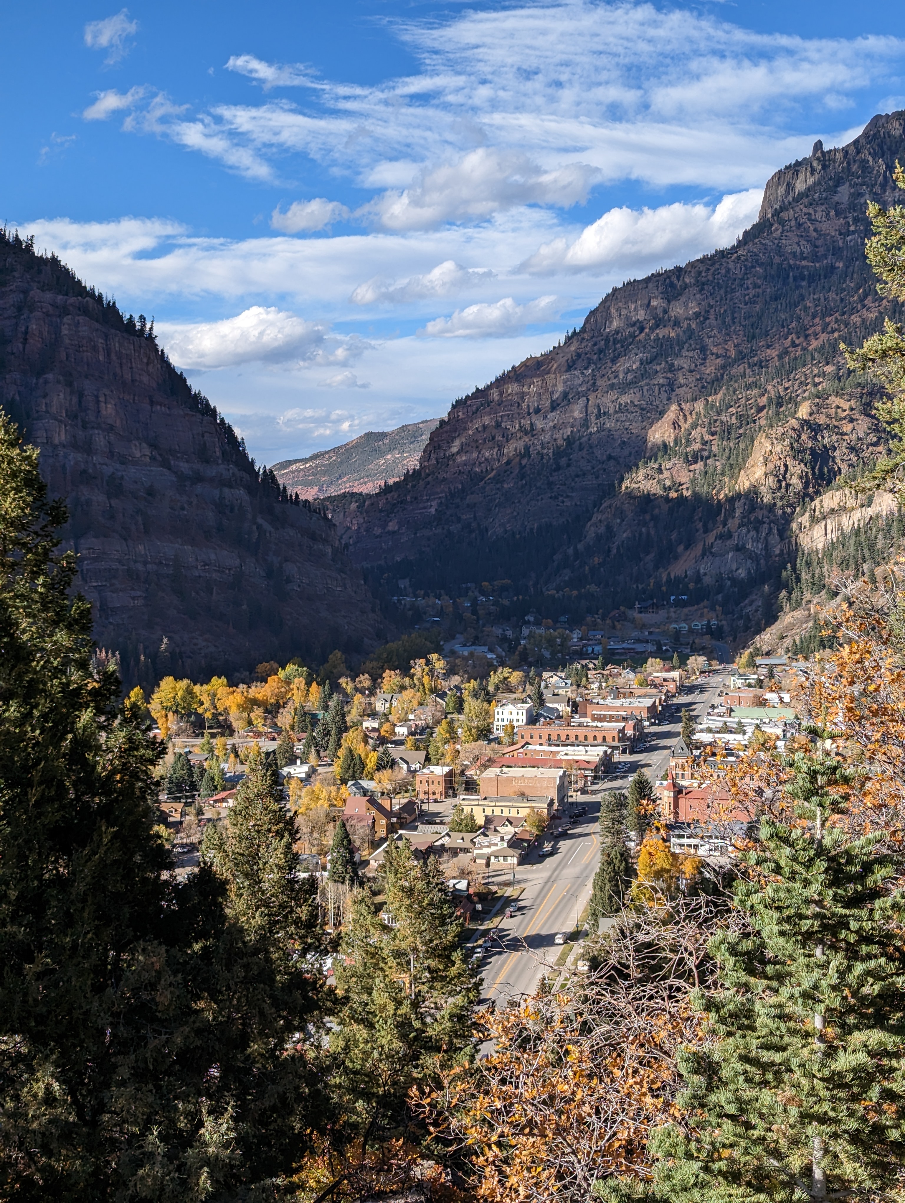
The first night I stayed in Ouray, I had no idea the San Juan Skyway was just there above it. The second time I was there for the Skyway, and I came ready. Ouray is at the back of a classic box canyon, which narrows and finally terminates in a sharp slope. The skyway starts by switch-backing up that slope, giving outstanding views of Ouray, and then transitions into a narrow two-lane road clinging to the side of the mountain.
I’m going to be honest, though – I don’t remember finding the experience remotely scary. I remember enjoying my accelerator pedal, and plenty of fun slaloming. Not much else. I think I’ll have to drive it again. I’ll report back if I get the true “Million Dollar Highway” experience the second time.
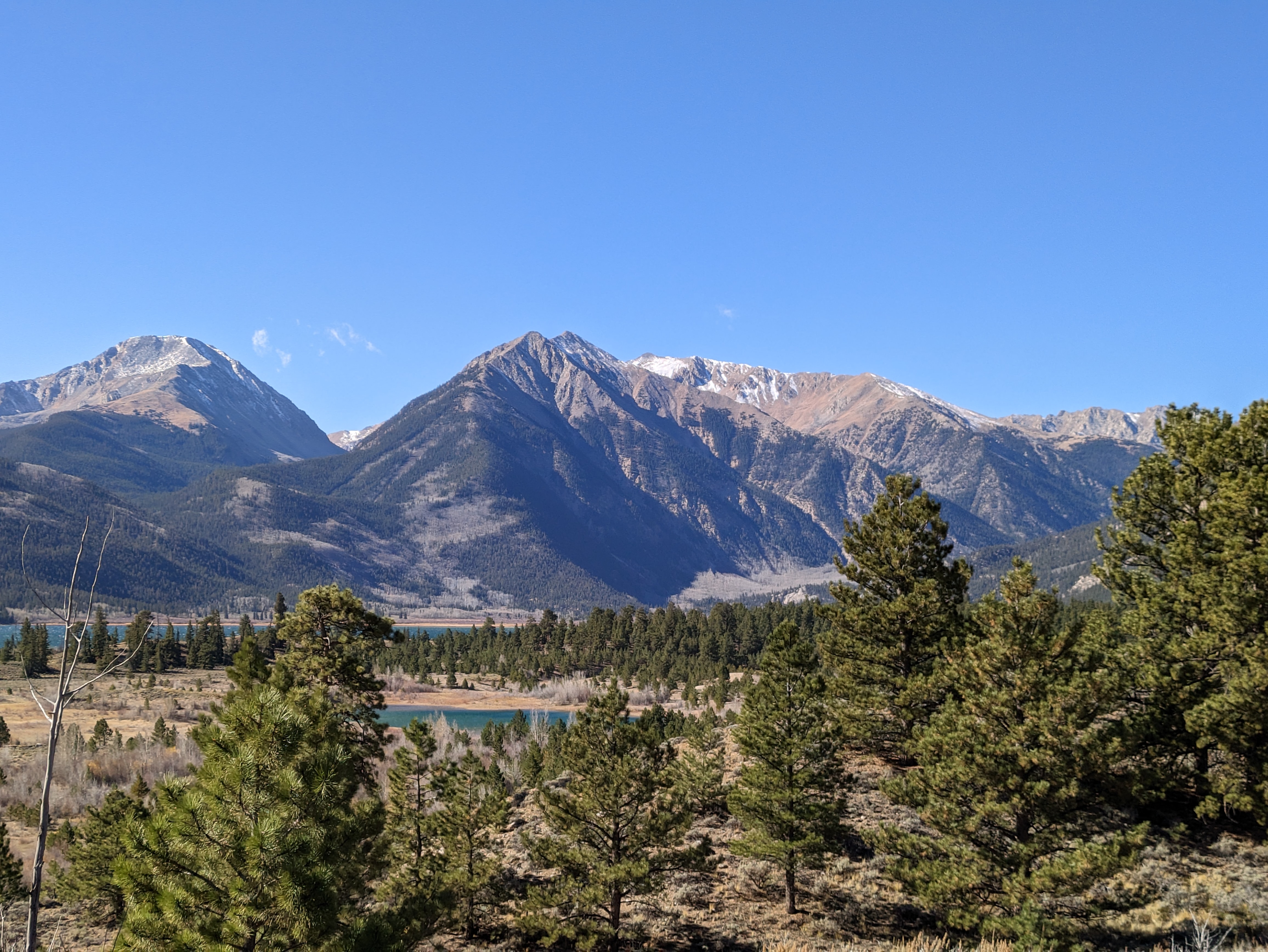
Top of the Rockies
Top of the Rockies was everything I expected it to be – classic Rocky Mountain views. I felt like I was climbing up, and up, and up, and seeing incredible mountains, open valleys, and panoramic views. And hopping out at what felt like the top, I truly felt like I was on the top, looking down. It was a lot like being on Trail Ridge Road in that way.
Honorable mentions
I’ll give honorable mentions to two roads in southern Wyoming that were just incredible: Battle Pass, where I’ll return to see the aspens, and the Snowy Range, where I’ll return as many times as I can just for that view and hike at the end. I wish I could post a photo for you all!
What’s next
Oh, I have a lot to do. I could return to almost any of these roads, and I likely will.
When I return is a bit tricky. Last year, I thought I beat the first winter storm by arriving in Durango on October 22nd. Little did I know, when I woke up I was dealing with heavy rain and mist at 6500 feet and as the passes climbed through 8000, it turned to snow. And let me tell you, a BMW M240i sports car with 340 HP and three-season high-performance tires is not the right place to find yourself in 3 inches of fresh slush and barely 100 yards of visibility. I turned around 1500 vertical feet before the pass, and got tailgated (sigh) as I crawled down the hill at 25 mph trying not to crash. Gently testing the brakes proved I was not in the right car at the right time.
I hope to hit Dinosaur Diamond again, given how much I loved camping in Dinosaur National Monument. I’d also love to see Flat Tops Trail, the rest of West Elk Loop, and Unaweek Tabagauche. Plus the Million Dollar Highway again, and the Alpine Loop with the Subaru.
But if there’s one road I could see again, in a great touring car, it would be Highway 395 in California following the eastern Sierra Nevada mountains, and all the mountain passes there. That’s where the cover photo is from (sorry, I tricked you). So far, few of the Colorado roads have come close to any of what’s available in the Sierra Nevadas for peace, stunning scenery, steep, twisty roads. I’d love to get my car over there again (no biggie – it’s “only” 1000 miles).